Brashear's Stand and Old Trace is located on the Natchez Trace Parkway at milepost 104.5.

Hiking Trail a short loop trail along a section of the Old Trace
Old Trace
Brashear's Stand and Old Trace - Natchez Trace

Photo Credit: Tony Turnbow - Natchez Trace Parkway Association
Scroll down the page to view more pictures!

Brashear's Stand was located here. In 1806 the stand was advertised as "a house of entertainment in the wilderness."

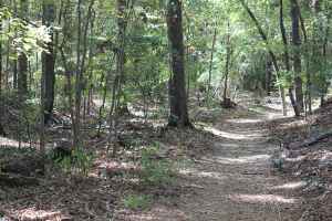
Two portions of the old wilderness road, the Old Natchez Trace, are preserved here. Nearly 500 miles long, it grew from Indian trails to a national road and communications link between the old southwest and the United States to the northeast.

A short loop walk lets you see both sections of the Old Natchez Trace. A new trail and boardwalk connects the area to the nearby Mississippi Crafts Center. The Brashear's Stand site also has access to the paved Ridgeland Multi-Use Path.

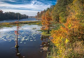
Brashear's Stand and Old Trace Photo Gallery
More info about Brashear's Stand and Old Trace and similar sites.
  • Click for a Location Map
  • Latitude: 32.4246833
    Longitude: -90.088983
    Elevation (approximate): 292 feet
    Milepost: 104.5
Next stop to the South Next stop to the North Natchez Trace Hiking Trails Old Natchez Trace Sites
Facebook User Comments about Brashear's Stand and Old Trace

Natchez Trace Travel: Home - Facebook - Instagram - Merchandise

Back to Top