Rocky Springs contact station restrooms are closed. There is no potable water anywhere at Rocky Springs due to a leak on the water line before it enters the Natchez Trace Parkway. The Rocky Springs campground restrooms toilets are open.
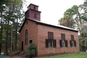
The Town of Rocky Springs. At the end of this trail is evidence of a once thriving community. First settled in the late 1790s, the town grew from a watering place along the Natchez Trace, and took its name from the source of that water - the rocky springs. In 1860, a total of 2,616 people lived in this area covering about 25 square miles. The population of the town proper included three merchants, four physicians, four teachers, three clergy and 13 artisans; while the surrounding farming community included 54 planters, 28 overseers and over 2,000 slaves who nurtured the crop that made the town possible - cotton. Civil War, Yellow Fever, destructive crop insects and poor land management brought an end to this once prosperous rural community.

Today, the Rocky Springs site includes a 22-site campground, picnic tables and restrooms.
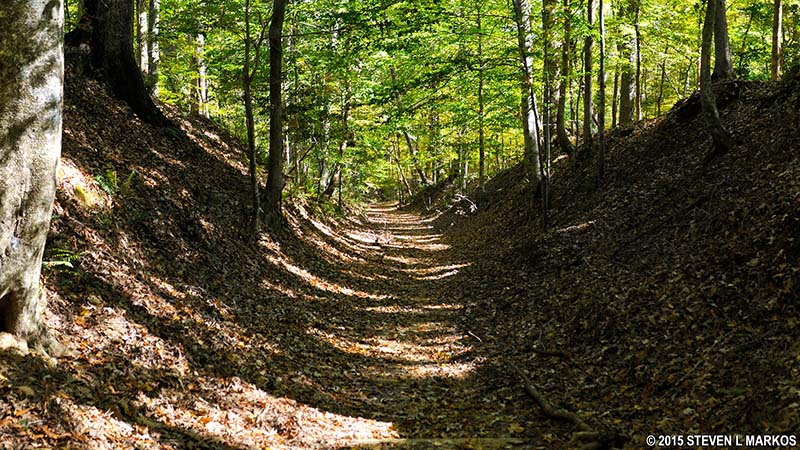
Hiking options include: a hike-able section of the Old Natchez Trace, self-guiding walking trails through the old town site and the spring and access to the 7 mile-long Rocky Springs Trail (a segment of the Natchez Trace National Scenic Trail) - you can hike south about three miles to the Owens Creek Waterfall site (the four mile section of the Rocky Springs trail from the campground north to its northern terminus at Fisher Ferry Road is currently closed).

Rocky Springs Merchandise
T-Shirts, Sweatshirts, Stickers, Mugs and Water Bottles