Twentymile Bottom, now cultivated, was typical of the many low areas along streams through which the Natchez Trace passed.
In 1812, Reverend John Johnson stopped at old Factors Stand near this bottom and wrote this account of bottomland travel, "I have this day swam my horse five times, bridged one creek, forded several others besides the swamp we had to wade through. At night we had a shower of rain. Took up my usual lodging on the ground in company with several Indians."
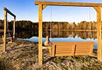
Twentymile Bottom Overlook Photo Gallery

View of the parkway and beyond from the overlook.

You can drive to the overlook!

Parkway view.

Lone picnic table.

Fall foliage at Twentymile Bottom Overlook.