Natchez Trace Indian History
Indian history is abundant along the Natchez Trace Parkway. Over 400 miles of the original Old Trace footpath went through Chickasaw, Choctaw and Natchez territory.
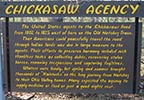
In 1796 when Tennessee became a state the Tennessee Valley Divide located just 20 miles south of the current northern terminus of the parkway was the dividing line between the United States and the Chickasaw Nation. Agreements between the US and the Indian Nations allowed travelers and mail delivery to pass through Indian Territory from Nashville to Natchez along the Old Trace.
Tennessee - Alabama - Mississippi
Indian History in Tennessee along the Natchez Trace Parkway

This "summary preview" of each Tennessee Natchez Trace Indian History site includes the site name, milepost location and major features.

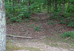
milepost 423.9 - Hiking Trail, Indian History
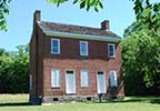
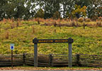
Gordon House and Duck River Ferry Site
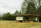
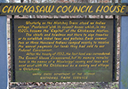
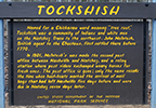
milepost 407.7 - Restroom, History/Nature Exhibit, Old Trace, Indian History, Top 30 Site
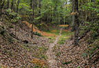
milepost 397.4 - Old Trace, Indian History
Indian History in Alabama along the Natchez Trace Parkway
This "summary preview" of each Alabama Natchez Trace Indian History site includes the site name, milepost location and major features.

Wichahpi Commemorative Stone Wall
The "stone wall" is located just east of the parkway near milepost 338 on Lauderdale County Road 8. - Indian History, Top 30 Site

Sacred Way Sanctuary is located 5 miles east of the parkway (exit onto AL Hwy 20 near milepost 336) on Lauderdale County Road 200.

milepost 327.3 - Indian History, Restroom, Picnic Area, Old Trace, Top 30 Site
milepost 320.3 - Old Trace, Indian History
Indian History in Mississippi along the Natchez Trace Parkway
This "summary preview" of each Mississippi Natchez Trace Indian History site includes the site name, milepost location and major features.

milepost 308.8 - Indian History
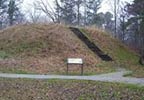
milepost 286.7 - Restroom, Picnic Area, Indian History, Top 30 Site

milepost 263.9 - Hiking Trail, Scenic Overlook, Indian History
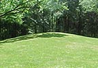
milepost 261.8 - Hiking Trail, Indian History, Top 30 Site
milepost 251.1 - Indian History
Exit the Trace at milepost 243.1 and travel west 3 miles.
milepost 241.4 - Indian History
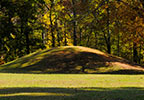
milepost 232.4 - Indian History, Top 30 Site


milepost 128.4 - Hiking Trail, Indian History

milepost 100.7 - Indian History

milepost 61.0 - History/Nature Exhibit, Indian History
milepost 45.7 - Old Trace, Indian History, Hiking Trail
milepost 45.7 - Indian History

milepost 10.3 - Indian History, Top 30 Site

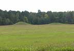
Grand Village of the Natchez Indians
Exit the Trace at milepost 0 (southern terminus) onto Liberty Road. Turn onto U.S. Highway 61 South (Seargent S. Prentiss Drive). Turn left onto Jefferson Davis Boulevard. The Grand Village of the Natchez Indians will be on your right.
Note: for your convenience the National Park Service displays a milepost on the east side of the parkway. Mileposts start at 0 on the southern end of the Trace near Natchez and end at 444 at the northern terminus (The Natchez Trace Parkway is 444 miles long.). Throughout this website, mileposts are used to help you locate attractions along the trace and exits on/off the Trace to help you find towns, attractions and bed and breakfasts located just off the Trace.