Natchez Trace Parkway South to North Bicycle Day Routes

One Day, South to North Natchez Trace Bicycle Routes starting in:
- Natchez, MS (Southern Terminus at milepost 0)
- Port Gibson, MS (milepost 39-41)
- Raymond, MS (milepost 76 or 79)
- Ridgeland, MS (milepost 100)
- Carthage, MS area (milepost 136.4)
- Kosciusko, MS (milepost 160)
- French Camp, MS (milepost 181)
- Houston, MS (milepost 230)
- Tupelo, MS area (milepost 256 or 262 or 266 or 276)
- Belmont, MS (milepost 303) or Tishomingo, MS (milepost 307)
- Threet, AL (milepost 341)
- Collinwood, TN (milepost 355)
- Hohenwald, TN (milepost 385.9)
- Fly / Santa Fe, TN (milepost 416)
One Day, South to North Bicycle Routes starting in Natchez, MS (Southern Terminus at milepost 0)
Ride Stats
- Miles on Parkway: 41.6
- Elevation Gain:
1,835 feet (avg. 44.1 feet/mile)
Maximum Grade: 3.7% - Elevation Loss:
1,818 feet (avg. 43.7 feet/mile)
Minimum Grade: -5.3%
Click Here to View Route Details:
- Route Overview Map (Route along the Parkway and Routes to/from Lodging at start and end of the Day)
- Restrooms, Top 30 Favorite Sites, and Exits with Services Nearby Along the Way from Milepost 0 to Milepost 41
- Lodging, Featured Points of Interest and Food at the end of the Day near the Parkway at Milepost 30-39-41
Ride Stats
milepost 0 to milepost 76.3:
- Miles on Parkway: 76.8
- Elevation Gain:
3,091 feet (avg. 40.2 feet/mile)
Maximum Grade: 3.6% - Elevation Loss:
2,982 feet (avg. 38.8 feet/mile)
Minimum Grade: -5.2%
milepost 0 to milepost 79:
- Miles on Parkway: 79.6
- Elevation Gain:
3,198 feet (avg. 40.2 feet/mile)
Maximum Grade: 3.7% - Elevation Loss:
3,051 feet (avg. 38.3 feet/mile)
Minimum Grade: -5.3%
Click Here to View Route Details:
- Route Overview Map (Route along the Parkway and Routes to/from Lodging at start and end of the Day)
- Restrooms, Top 30 Favorite Sites, and Exits with Services Nearby Along the Way from Milepost 0 to Milepost 79
- Lodging, Featured Points of Interest and Food at the end of the Day near the Parkway at Milepost 76 and Milepost 79

Ride Stats
- Miles on Parkway and Multi-Use Path: 102
- Elevation Gain:
3,963 feet (avg. 38.9 feet/mile)
Maximum Grade: 3.7% - Elevation Loss:
3,756 feet (avg. 36.8 feet/mile)
Minimum Grade: -5.3%
Click Here to View Route Details:
- Route Overview Map (Route along the Parkway and Routes to/from Lodging at start and end of the Day)
- Restrooms, Top 30 Favorite Sites, and Exits with Services Nearby Along the Way from Milepost 0 to Milepost 101
- Lodging, Featured Points of Interest and Food at the end of the Day near the Parkway at Milepost 100-101
One Day, South to North Bicycle Routes starting in Port Gibson, MS (milepost 39-41)
Ride Stats
milepost 39-41 to milepost 76.3:
- Miles on Parkway: 37.2
- Elevation Gain:
1,372 feet (avg. 36.9 feet/mile)
Maximum Grade: 3.0% - Elevation Loss:
1,272 feet (avg. 34.2 feet/mile)
Minimum Grade: -3.1%
milepost 39-41 to milepost 79:
- Miles on Parkway: 39.8
- Elevation Gain:
1,470 feet (avg. 36.9 feet/mile)
Maximum Grade: 3.0% - Elevation Loss:
1,331 feet (avg. 33.4 feet/mile)
Minimum Grade: -3.1%
Click Here to View Route Details:
- Route Overview Map (Route along the Parkway and Routes to/from Lodging at start and end of the Day)
- Restrooms, Top 30 Favorite Sites, and Exits with Services Nearby Along the Way from Milepost 39 to Milepost 79
- Lodging, Featured Points of Interest and Food at the end of the Day near the Parkway at Milepost 76-79

Ride Stats
- Miles on Parkway: 62.3
- Elevation Gain:
2,247 feet (avg. 36.1 feet/mile)
Maximum Grade: 3.0% - Elevation Loss:
2,046 feet (avg. 32.8 feet/mile)
Minimum Grade: -3.1%
Click Here to View Route Details:
- Route Overview Map (Route along the Parkway and Routes to/from Lodging at start and end of the Day)
- Restrooms, Top 30 Favorite Sites, and Exits with Services Nearby Along the Way from Milepost 39 to Milepost 100
- Lodging, Featured Points of Interest and Food at the end of the Day near the Parkway at Milepost 100
One Day, South to North Bicycle Routes starting in Raymond, MS (milepost 76 or 79)
Ride Stats
milepost 76.3 to milepost 101:
- Miles on Parkway: 25.1
- Elevation Gain:
877 feet (avg. 34.9 feet/mile)
Maximum Grade: 2.4% - Elevation Loss:
774 feet (avg. 30.8 feet/mile)
Minimum Grade: -2.7%
milepost 79 to milepost 101:
- Miles on Parkway: 22.5
- Elevation Gain:
784 feet (avg. 34.8 feet/mile)
Maximum Grade: 2.4% - Elevation Loss:
725 feet (avg. 32.2 feet/mile)
Minimum Grade: -2.8%
Click Here to View Route Details:
- Route Overview Map (Route along the Parkway and Routes to/from Lodging at start and end of the Day)
- Restrooms, Top 30 Favorite Sites, and Exits with Services Nearby Along the Way from Milepost 79 to Milepost 100
- Lodging, Featured Points of Interest and Food at the end of the Day near the Parkway at Milepost 100-101
Ride Stats
milepost 76.3 to milepost 160:
- Miles on Parkway: 84.2
- Elevation Gain:
1,909 feet (avg. 22.7 feet/mile)
Maximum Grade: 2.3% - Elevation Loss:
1,744 feet (avg. 20.7 feet/mile)
Minimum Grade: -2.9%
milepost 79 to milepost 160:
- Miles on Parkway: 81.6
- Elevation Gain:
1,814 feet (avg. 22.2 feet/mile)
Maximum Grade: 2.3% - Elevation Loss:
1,692 feet (avg. 20.7 feet/mile)
Minimum Grade: -2.9%
Click Here to View Route Details:
- Route Overview Map (Route along the Parkway and Routes to/from Lodging at start and end of the Day)
- Restrooms, Top 30 Favorite Sites, and Exits with Services Nearby Along the Way from Milepost 76 to Milepost 160
- Lodging, Featured Points of Interest and Food at the end of the Day near the Parkway at Milepost 160
Ride Stats
milepost 76.3 to milepost 180.8:
- Miles on Parkway and Multi-Use Path: 106.1
- Elevation Gain:
2,538 feet (avg. 23.9 feet/mile)
Maximum Grade: 2.4% - Elevation Loss:
2,377 feet (avg. 22.4 feet/mile)
Minimum Grade: -3.4%
milepost 79 to milepost 180.8:
- Miles on Parkway and Multi-Use Path: 103.7
- Elevation Gain:
2,450 feet (avg. 23.6 feet/mile)
Maximum Grade: 2.4% - Elevation Loss:
2,331 feet (avg. 22.5 feet/mile)
Minimum Grade: -3.4%
Click Here to View Route Details:
- Route Overview Map (Route along the Parkway and Routes to/from Lodging at start and end of the Day)
- Restrooms, Top 30 Favorite Sites, and Exits with Services Nearby Along the Way from Milepost 76 to Milepost 181
- Lodging, Featured Points of Interest and Food at the end of the Day near the Parkway at Milepost 181
One Day, South to North Bicycle Routes starting in Ridgeland, MS (milepost 100-101)
Ride Stats
- Miles on Parkway (including 5.5 miles on Multi-Use Path): 36.5
- Elevation Gain:
843 feet (avg. 23.1 feet/mile)
Maximum Grade: 2.5% - Elevation Loss:
806 feet (avg. 22.1 feet/mile)
Minimum Grade: -2.8%
Click Here to View Route Details:
- Route Overview Map (Route along the Parkway and Routes to/from Lodging at start and end of the Day)
- Restrooms, Top 30 Favorite Sites, and Exits with Services Nearby Along the Way from Milepost 100 to Milepost 136.4
- Lodging, Featured Points of Interest and Food at the end of the Day near the Parkway at Milepost 136.4
Ride Stats
- Miles on Parkway (including 5.5 miles on Multi-Use Path): 60
- Elevation Gain:
1,185 feet (avg. 19.8 feet/mile)
Maximum Grade: 2.3% - Elevation Loss:
1,132 feet (avg. 18.9 feet/mile)
Minimum Grade: -2.7%
Click Here to View Route Details:
- Route Overview Map (Route along the Parkway and Routes to/from Lodging at start and end of the Day)
- Restrooms, Top 30 Favorite Sites, and Exits with Services Nearby Along the Way from Milepost 100 to Milepost 160
- Lodging, Featured Points of Interest and Food at the end of the Day near the Parkway at Milepost 160
Ride Stats
- Miles on Parkway (including 5.5 miles on Multi-Use Path): 81
- Elevation Gain:
1,694 feet (avg. 20.9 feet/mile)
Maximum Grade: 2.3% - Elevation Loss:
1,632 feet (avg. 20.1 feet/mile)
Minimum Grade: -3.4%
Click Here to View Route Details:
- Route Overview Map (Route along the Parkway and Routes to/from Lodging at start and end of the Day)
- Restrooms, Top 30 Favorite Sites, and Exits with Services Nearby Along the Way from Milepost 100 to Milepost 181
- Lodging, Featured Points of Interest and Food at the end of the Day near the Parkway at Milepost 181
Ride Stats
- Miles on Parkway (including 5.5 miles on Multi-Use Path): 130.1
- Elevation Gain:
3,105 feet (avg. 23.9 feet/mile)
Maximum Grade: 5.0% - Elevation Loss:
3,122 feet (avg. 24.0 feet/mile)
Minimum Grade: -4.6%
Click Here to View Route Details:
- Route Overview Map (Route along the Parkway and Routes to/from Lodging at start and end of the Day)
- Restrooms, Top 30 Favorite Sites, and Exits with Services Nearby Along the Way from Milepost 100 to Milepost 230
- Lodging, Featured Points of Interest and Food at the end of the Day near the Parkway at Milepost 230
One Day, South to North Bicycle Routes starting in the Carthage, MS area (milepost 136.4)
Ride Stats
- Miles on Parkway: 25.1
- Elevation Gain:
342 feet (avg. 13.6 feet/mile)
Maximum Grade: 1.3% - Elevation Loss:
327 feet (avg. 13.0 feet/mile)
Minimum Grade: -1.3%
Click Here to View Route Details:
- Route Overview Map (Route along the Parkway and Routes to/from Lodging at start and end of the Day)
- Restrooms, Top 30 Favorite Sites, and Exits with Services Nearby Along the Way from Milepost 136.4 to Milepost 160
- Lodging, Featured Points of Interest and Food at the end of the Day near the Parkway at Milepost 160
One Day, South to North Bicycle Routes starting in Kosciusko, MS (milepost 160)
Ride Stats
- Miles on Parkway: 20.6
- Elevation Gain:
543 feet (avg. 26.4 feet/mile)
Maximum Grade: 1.8% - Elevation Loss:
532 feet (avg. 25.8 feet/mile)
Minimum Grade: -3.1%
Click Here to View Route Details:
- Route Overview Map (Route along the Parkway and Routes to/from Lodging at start and end of the Day)
- Restrooms, Top 30 Favorite Sites, and Exits with Services Nearby Along the Way from Milepost 160 to Milepost 180.8
- Lodging, Featured Points of Interest and Food at the end of the Day near the Parkway at Milepost 180.8
Ride Stats
- Miles on Parkway: 69.9
- Elevation Gain:
2,005 feet (avg. 28.7 feet/mile)
Maximum Grade: 4.7% - Elevation Loss:
2,085 feet (avg. 29.8 feet/mile)
Minimum Grade: -4.3%
Click Here to View Route Details:
- Route Overview Map (Route along the Parkway and Routes to/from Lodging at start and end of the Day)
- Restrooms, Top 30 Favorite Sites, and Exits with Services Nearby Along the Way from Milepost 160 to Milepost 230
- Lodging, Featured Points of Interest and Food at the end of the Day near the Parkway at Milepost 230
One Day, South to North Bicycle Routes starting in French Camp, MS (milepost 180.8)
Ride Stats
- Miles on Parkway: 48.9
- Elevation Gain:
1,481 feet (avg. 30.3 feet/mile)
Maximum Grade: 4.7% - Elevation Loss:
1,560 feet (avg. 31.9 feet/mile)
Minimum Grade: -4.4%
Click Here to View Route Details:
- Route Overview Map (Route along the Parkway and Routes to/from Lodging at start and end of the Day)
- Restrooms, Top 30 Favorite Sites, and Exits with Services Nearby Along the Way from Milepost 180.8 to Milepost 230
- Lodging, Featured Points of Interest and Food at the end of the Day near the Parkway at Milepost 230
Ride Stats
milepost 180.8 to milepost 256:
- Miles on Parkway: 74.6
- Elevation Gain:
2,277 feet (avg. 30.6 feet/mile)
Maximum Grade: 4.7% - Elevation Loss:
2,386 feet (avg. 32.0 feet/mile)
Minimum Grade: -4.4%
milepost 180.8 to milepost 262.5:
- Miles on Parkway: 82.0
- Elevation Gain:
2,459 feet (avg. 30.0 feet/mile)
Maximum Grade: 4.7% - Elevation Loss:
2,538 feet (avg. 31.0 feet/mile)
Minimum Grade: -4.4%
milepost 180.8 to milepost 276:
- Miles on Parkway: 95.5
- Elevation Gain:
2,942 feet (avg. 30.8 feet/mile)
Maximum Grade: 4.8% - Elevation Loss:
2,924 feet (avg. 30.6 feet/mile)
Minimum Grade: -4.4%
Click Here to View Route Details:
- Route Overview Map (Route along the Parkway and Routes to/from Lodging at start and end of the Day)
- Restrooms, Top 30 Favorite Sites, and Exits with Services Nearby Along the Way from Milepost 181 to Milepost 276
- Lodging, Featured Points of Interest and Food at the end of the Day near the Parkway at Mileposts 256, 262 and 276

One Day, South to North Bicycle Routes starting in Houston, MS (milepost 230)
Ride Stats
milepost 230 to milepost 256:
- Miles on Parkway: 25.7
- Elevation Gain:
802 feet (avg. 31.2 feet/mile)
Maximum Grade: 2.4% - Elevation Loss:
833 feet (avg. 32.4 feet/mile)
Minimum Grade: -3.3%
milepost 230 to milepost 262.5:
- Miles on Parkway: 33.1
- Elevation Gain:
983 feet (avg. 29.7 feet/mile)
Maximum Grade: 2.4% - Elevation Loss:
984 feet (avg. 29.7 feet/mile)
Minimum Grade: -2.5%
milepost 230 to milepost 276:
- Miles on Parkway: 46.6
- Elevation Gain:
1,456 feet (avg. 31.2 feet/mile)
Maximum Grade: 3.5% - Elevation Loss:
1,360 feet (avg. 29.2 feet/mile)
Minimum Grade: -3.5%
Click Here to View Route Details:
- Route Overview Map (Route along the Parkway and Routes to/from Lodging at start and end of the Day)
- Restrooms, Top 30 Favorite Sites, and Exits with Services Nearby Along the Way from Milepost 230 to Milepost 276
- Lodging, Featured Points of Interest and Food at the end of the Day near the Parkway at Mileposts 256, 262 and 276
Ride Stats
milepost 230 to milepost 293:
- Miles on Parkway: 64.1
- Elevation Gain:
2,171 feet (avg. 33.9 feet/mile)
Maximum Grade: 3.5% - Elevation Loss:
2,133 feet (avg. 33.3 feet/mile)
Minimum Grade: -4.5%
milepost 230 to milepost 303:
- Miles on Parkway: 73.5
- Elevation Gain:
2,675 feet (avg. 36.4 feet/mile)
Maximum Grade: 4.9% - Elevation Loss:
2,406 feet (avg. 32.7 feet/mile)
Minimum Grade: -5.0%
milepost 230 to milepost 307:
- Miles on Parkway: 78.5
- Elevation Gain:
2,781 feet (avg. 36.4 feet/mile)
Maximum Grade: 6.5% - Elevation Loss:
2,644 feet (avg. 32.7 feet/mile)
Minimum Grade: -5.0%
Click Here to View Route Details:
- Route Overview Map (Route along the Parkway and Routes to/from Lodging at start and end of the Day)
- Restrooms, Top 30 Favorite Sites, and Exits with Services Nearby Along the Way from Milepost 230 to Milepost 307
- Lodging, Featured Points of Interest and Food at the end of the Day near the Parkway at Mileposts 293, 303 or 307

Ride Stats
milepost 230 to milepost 338:
- Miles on Parkway: 109.4
- Elevation Gain:
4,170 feet (avg. 38.1 feet/mile)
Maximum Grade: 6.4% - Elevation Loss:
3,851 feet (avg. 35.2 feet/mile)
Minimum Grade: -5.7%
milepost 230 to milepost 355:
- Miles on Parkway: 126.6
- Elevation Gain:
4,820 feet (avg. 38.1 feet/mile)
Maximum Grade: 6.4% - Elevation Loss:
4,087 feet (avg. 32.3 feet/mile)
Minimum Grade: -5.8%
Click Here to View Route Details:
- Route Overview Map (Route along the Parkway and Routes to/from Lodging at start and end of the Day)
- Restrooms, Top 30 Favorite Sites, and Exits with Services Nearby Along the Way from Milepost 230 to Milepost 355
- Lodging, Featured Points of Interest and Food at the end of the Day near the Parkway at Milepost 338 and Milepost 355
One Day, South to North Bicycle Routes starting in the Tupelo, MS area (milepost 262, 266 or 276)
Ride Stats
milepost 262.5 to milepost 293:
- Miles on Parkway: 30.9
- Elevation Gain:
1,170 feet (avg. 37.9 feet/mile)
Maximum Grade: 3.6% - Elevation Loss:
1,146 feet (avg. 37.1 feet/mile)
Minimum Grade: -4.7%
milepost 262.5 to milepost 303:
- Miles on Parkway: 40.4
- Elevation Gain:
1,681 feet (avg. 41.6 feet/mile)
Maximum Grade: 5.1% - Elevation Loss:
1,418 feet (avg. 35.1 feet/mile)
Minimum Grade: -5.3%
milepost 262.5 to milepost 307:
- Miles on Parkway: 45.3
- Elevation Gain:
1,809 feet (avg. 39.9 feet/mile)
Maximum Grade: 6.7% - Elevation Loss:
1,678 feet (avg. 37.0 feet/mile)
Minimum Grade: -5.1%
milepost 266 to milepost 293:
- Miles on Parkway: 27.6
- Elevation Gain:
1,086 feet (avg. 39.3 feet/mile)
Maximum Grade: 3.6% - Elevation Loss:
1,046 feet (avg. 37.9 feet/mile)
Minimum Grade: -4.8%
milepost 266 to milepost 303:
- Miles on Parkway: 36.8
- Elevation Gain:
1,598 feet (avg. 43.4 feet/mile)
Maximum Grade: 5.1% - Elevation Loss:
1,323 feet (avg. 36.0 feet/mile)
Minimum Grade: -4.7%
milepost 266 to milepost 307:
- Miles on Parkway: 41.8
- Elevation Gain:
1,730 feet (avg. 41.2 feet/mile)
Maximum Grade: 6.7% - Elevation Loss:
1,580 feet (avg. 37.8 feet/mile)
Minimum Grade: -5.2%
milepost 276 to milepost 293:
- Miles on Parkway: 17.5
- Elevation Gain:
715 feet (avg. 40.9 feet/mile)
Maximum Grade: 3.1% - Elevation Loss:
771 feet (avg. 44.1 feet/mile)
Minimum Grade: -4.7%
milepost 276 to milepost 303:
- Miles on Parkway: 26.9
- Elevation Gain:
1,224 feet (avg. 45.5 feet/mile)
Maximum Grade: 5.0% - Elevation Loss:
1,048 feet (avg. 39.0 feet/mile)
Minimum Grade: -4.6%
milepost 276 to milepost 307:
- Miles on Parkway: 31.9
- Elevation Gain:
1,367 feet (avg. 42.9 feet/mile)
Maximum Grade: 6.4% - Elevation Loss:
1,320 feet (avg. 41.4 feet/mile)
Minimum Grade: -5.0%
Click Here to View Route Details:
- Route Overview Map (Route along the Parkway and Routes to/from Lodging at start and end of the Day)
- Restrooms, Top 30 Favorite Sites, and Exits with Services Nearby Along the Way from Milepost 262 to Milepost 307
- Lodging, Featured Points of Interest and Food at the end of the Day near the Parkway at Mileposts 293, 303 and 307
Ride Stats
milepost 262.5 to milepost 338:
- Miles on Parkway: 76.2
- Elevation Gain:
3,232 feet (avg. 42.4 feet/mile)
Maximum Grade: 6.6% - Elevation Loss:
2,925 feet (avg. 38.4 feet/mile)
Minimum Grade: -5.8%
milepost 266 to milepost 338:
- Miles on Parkway: 72.7
- Elevation Gain:
3,090 feet (avg. 42.5 feet/mile)
Maximum Grade: 6.5% - Elevation Loss:
2,765 feet (avg. 38.0 feet/mile)
Minimum Grade: -5.8%
milepost 276 to milepost 338:
- Miles on Parkway: 62.8
- Elevation Gain:
2,742 feet (avg. 43.7 feet/mile)
Maximum Grade: 6.4% - Elevation Loss:
2,516 feet (avg. 40.1 feet/mile)
Minimum Grade: -5.7%
Click Here to View Route Details:
- Route Overview Map (Route along the Parkway and Routes to/from Lodging at start and end of the Day)
- Restrooms, Top 30 Favorite Sites, and Exits with Services Nearby Along the Way from Milepost 262 to Milepost 338
- Lodging, Featured Points of Interest and Food at the end of the Day near the Parkway at Milepost 338
Ride Stats
milepost 262.5 to milepost 355:
- Miles on Parkway: 93.4
- Elevation Gain:
3,840 feet (avg. 41.1 feet/mile)
Maximum Grade: 6.5% - Elevation Loss:
3,119 feet (avg. 33.4 feet/mile)
Minimum Grade: -5.8%
milepost 266 to milepost 355:
- Miles on Parkway: 89.9
- Elevation Gain:
3,744 feet (avg. 41.6 feet/mile)
Maximum Grade: 6.5% - Elevation Loss:
3,006 feet (avg. 33.4 feet/mile)
Minimum Grade: -5.8%
milepost 276 to milepost 355:
- Miles on Parkway: 80
- Elevation Gain:
3,402 feet (avg. 42.5 feet/mile)
Maximum Grade: 6.4% - Elevation Loss:
2,763 feet (avg. 34.5 feet/mile)
Minimum Grade: -5.7%
Click Here to View Daily Route:
- Route Overview Map (Route along the Parkway and Routes to/from Lodging at start and end of the Day)
- Restrooms, Top 30 Favorite Sites, and Exits with Services Nearby Along the Way from Milepost 262 to Milepost 355
- Lodging, Featured Points of Interest and Food at the end of the Day near the Parkway at Milepost 355
One Day, South to North Bicycle Routes starting in Belmont, MS (milepost 303) or Tishomingo, MS (milepost 307)
Ride Stats
milepost 303 to milepost 338:
- Miles on Parkway: 35.5
- Elevation Gain:
1,549 feet (avg. 43.6 feet/mile)
Maximum Grade: 6.4% - Elevation Loss:
1,560 feet (avg. 43.9 feet/mile)
Minimum Grade: -5.7%
milepost 307 to milepost 338:
- Miles on Parkway: 30.9
- Elevation Gain:
1,376 feet (avg. 44.5 feet/mile)
Maximum Grade: 6.3% - Elevation Loss:
1,203 feet (avg. 38.9 feet/mile)
Minimum Grade: -5.7%
Click Here to View Route Details:
- Route Overview Map (Route along the Parkway and Routes to/from Lodging at start and end of the Day)
- Restrooms, Top 30 Favorite Sites, and Exits with Services Nearby Along the Way from Milepost 303 to Milepost 338
- Lodging, Featured Points of Interest and Food at the end of the Day near the Parkway at Milepost 338
Ride Stats
milepost 303 to milepost 355:
- Miles on Parkway: 52.7
- Elevation Gain:
2,215 feet (avg. 42.0 feet/mile)
Maximum Grade: 6.3% - Elevation Loss:
1,766 feet (avg. 33.5 feet/mile)
Minimum Grade: -5.6%
milepost 307 to milepost 355:
- Miles on Parkway: 48.1
- Elevation Gain:
2,038 feet (avg. 42.4 feet/mile)
Maximum Grade: 6.3% - Elevation Loss:
1,450 feet (avg. 30.1 feet/mile)
Minimum Grade: -5.7%
Click Here to View Route Details:
- Route Overview Map (Route along the Parkway and Routes to/from Lodging at start and end of the Day)
- Restrooms, Top 30 Favorite Sites, and Exits with Services Nearby Along the Way from Milepost 303 to Milepost 355
- Lodging, Featured Points of Interest and Food at the end of the Day near the Parkway at Milepost 355
One Day, South to North Bicycle Routes starting in Threet, AL (milepost 341)
Ride Stats
- Miles on Parkway: 14.2
- Elevation Gain:
608 feet (avg. 42.8 feet/mile)
Maximum Grade: 3.7% - Elevation Loss:
204 feet (avg. 14.4 feet/mile)
Minimum Grade: -3.5%
Click Here to View Route Details:
- Route Overview Map (Route along the Parkway and Routes to/from Lodging at start and end of the Day)
- Restrooms, Top 30 Favorite Sites, and Exits with Services Nearby Along the Way from Milepost 341 to Milepost 355
- Lodging, Featured Points of Interest and Food at the end of the Day near the Parkway at Milepost 355
Ride Stats
- Miles on Parkway: 45.1
- Elevation Gain:
1,941 feet (avg. 43.0 feet/mile):
Maximum Grade: 4.4% - Elevation Loss:
1,652 feet (avg. 36.6 feet/mile):
Minimum Grade: -4.7%
Click Here to View Route Details:
- Route Overview Map (Route along the Parkway and Routes to/from Lodging at start and end of the Day)
- Restrooms, Top 30 Favorite Sites, and Exits with Services Nearby Along the Way from Milepost 341 to Milepost 385.9
- Lodging, Featured Points of Interest and Food at the end of the Day near the Parkway at Milepost 385.9
Ride Stats
milepost 341 to milepost 442:
- Miles on Parkway: 101.9
- Elevation Gain:
5,556 feet (avg. 54.5 feet/mile)
Maximum Grade: 8.3% - Elevation Loss: 5,552 feet (avg. 54.5 feet/mile)
Minimum Grade: -9.7%
milepost 355 to milepost 442:
- Miles on Parkway: 87.7
- Elevation Gain:
5,008 feet (avg. 57.1 feet/mile)
Maximum Grade: 8.4% - Elevation Loss: 5,399 feet (avg. 61.6 feet/mile)
Minimum Grade: -9.8%
Click Here to View Route Details:
- Route Overview Map (Route along the Parkway and Routes to/from Lodging at start and end of the Day)
- Restrooms, Top 30 Favorite Sites, and Exits with Services Nearby Along the Way from Milepost 341 to Milepost 442
- Lodging, Featured Points of Interest and Food at the end of the Day near the Parkway at Milepost 442
One Day, South to North Bicycle Routes starting in Collinwood, TN (milepost 355)
Ride Stats
- Miles on Parkway: 31.2
- Elevation Gain:
1,287 feet (avg. 41.3 feet/mile)
Maximum Grade: 4.4% - Elevation Loss:
1,430 feet (avg. 45.8 feet/mile)
Minimum Grade: -4.7%
Click Here to View Route Details:
- Route Overview Map (Route along the Parkway and Routes to/from Lodging at start and end of the Day)
- Restrooms, Top 30 Favorite Sites, and Exits with Services Nearby Along the Way from Milepost 355 to Milepost 385.9
- Lodging, Featured Points of Interest and Food at the end of the Day near the Parkway at Milepost 385.9
Ride Stats
- Miles on Parkway: 61.1
- Elevation Gain:
3,195 feet (avg. 52.3 feet/mile)
Maximum Grade: 8.2% - Elevation Loss:
3,439 feet (avg. 56.3 feet/mile)
Minimum Grade: -9.4%
Click Here to View Route Details:
- Route Overview Map (Route along the Parkway and Routes to/from Lodging at start and end of the Day)
- Restrooms, Top 30 Favorite Sites, and Exits with Services Nearby Along the Way from Milepost 355 to Milepost 416
- Lodging, Featured Points of Interest and Food at the end of the Day near the Parkway at Milepost 416
Ride Stats
- Miles on Parkway: 87.8
- Elevation Gain:
5,011 feet (avg. 57.1 feet/mile)
Maximum Grade: 8.4% - Elevation Loss:
5,401 feet (avg. 61.5 feet/mile)
Minimum Grade: -9.8%
Click Here to View Route Details:
- Route Overview Map (Route along the Parkway and Routes to/from Lodging at start and end of the Day)
- Restrooms, Top 30 Favorite Sites, and Exits with Services Nearby Along the Way from Milepost 355 to Milepost 442
- Lodging, Featured Points of Interest and Food at the end of the Day near the Parkway at Milepost 442
One Day, South to North Bicycle Routes starting in Hohenwald, TN (milepost 386)
Ride Stats
- Miles on Parkway: 29.9
- Elevation Gain:
1,988 feet (avg. 66.5 feet/mile)
Maximum Grade: 8.3% - Elevation Loss:
2,075 feet (avg. 69.4 feet/mile)
Minimum Grade: -9.7%
Click Here to View Route Details:
- Route Overview Map (Route along the Parkway and Routes to/from Lodging at start and end of the Day)
- Restrooms, Top 30 Favorite Sites, and Exits with Services Nearby Along the Way from Milepost 385.9 to Milepost 416
- Lodging, Featured Points of Interest and Food at the end of the Day near the Parkway at Milepost 416
Ride Stats
- Miles on Parkway: 56.6
- Elevation Gain:
3,845 feet (avg. 67.9 feet/mile)
Maximum Grade: 8.5% - Elevation Loss:
4,085 feet (avg. 72.2 feet/mile)
Minimum Grade: -10.2%
Click Here to View Route Details:
- Route Overview Map (Route along the Parkway and Routes to/from Lodging at start and end of the Day)
- Restrooms, Top 30 Favorite Sites, and Exits with Services Nearby Along the Way from Milepost 385.9 to Milepost 442
- Lodging, Featured Points of Interest and Food at the end of the Day near the Parkway at Milepost 442
One Day, South to North Bicycle Routes starting in Fly / Santa Fe, TN (milepost 416)
Ride Stats:
- Miles on Parkway: 26.7
- Elevation Gain:
1,807 feet (avg. 67.7 feet/mile)
Maximum Grade: 6.7% - Elevation Loss:
1,969 feet (avg. 73.7 feet/mile)
Minimum Grade: -8.3%
Click Here to View Route Details:
- Route Overview Map (Route along the Parkway and Routes to/from Lodging at start and end of the Day)
- Restrooms, Top 30 Favorite Sites, and Exits with Services Nearby Along the Way from Milepost 416 to Milepost 442
- Lodging, Featured Points of Interest and Food at the end of the Day near the Parkway at Milepost 442
Do you appreciate this information and advice?
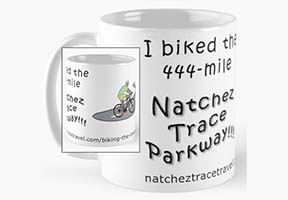
I/We "Bicycled the Natchez Trace" Merchandise
Natchez Trace Travel Planner
Parkway Map, Top 30 Favorite Sites and Nearby Lodging Map, Lodging Flyer